Svenesis GalacticView 3D
Version 0.9.0 – GPL-3.0-or-later
🚧 Pre-release (v0.9.0) – Public preview. Not yet submitted to the official Siril Script Repository. Download directly from GitHub.
Places your plate-solved astrophoto inside an interactive 3D model of the Milky Way or the Local Group. The script automatically determines whether your image field is a galactic target (within 150,000 light-years) or a cosmic one (beyond), and selects the appropriate scene accordingly – showing either the Milky Way spiral arms with Earth marked in the Orion Spur, or a view of neighboring galaxies in the Local Group.
Two Auto Modes
- Galactic mode (< 150,000 ly) – shows the Milky Way spiral arms, galactic disk, bulge, and the viewing ray from Earth to the image field
- Cosmic mode (≥ 150,000 ly) – switches to a Local Group view showing neighboring galaxies
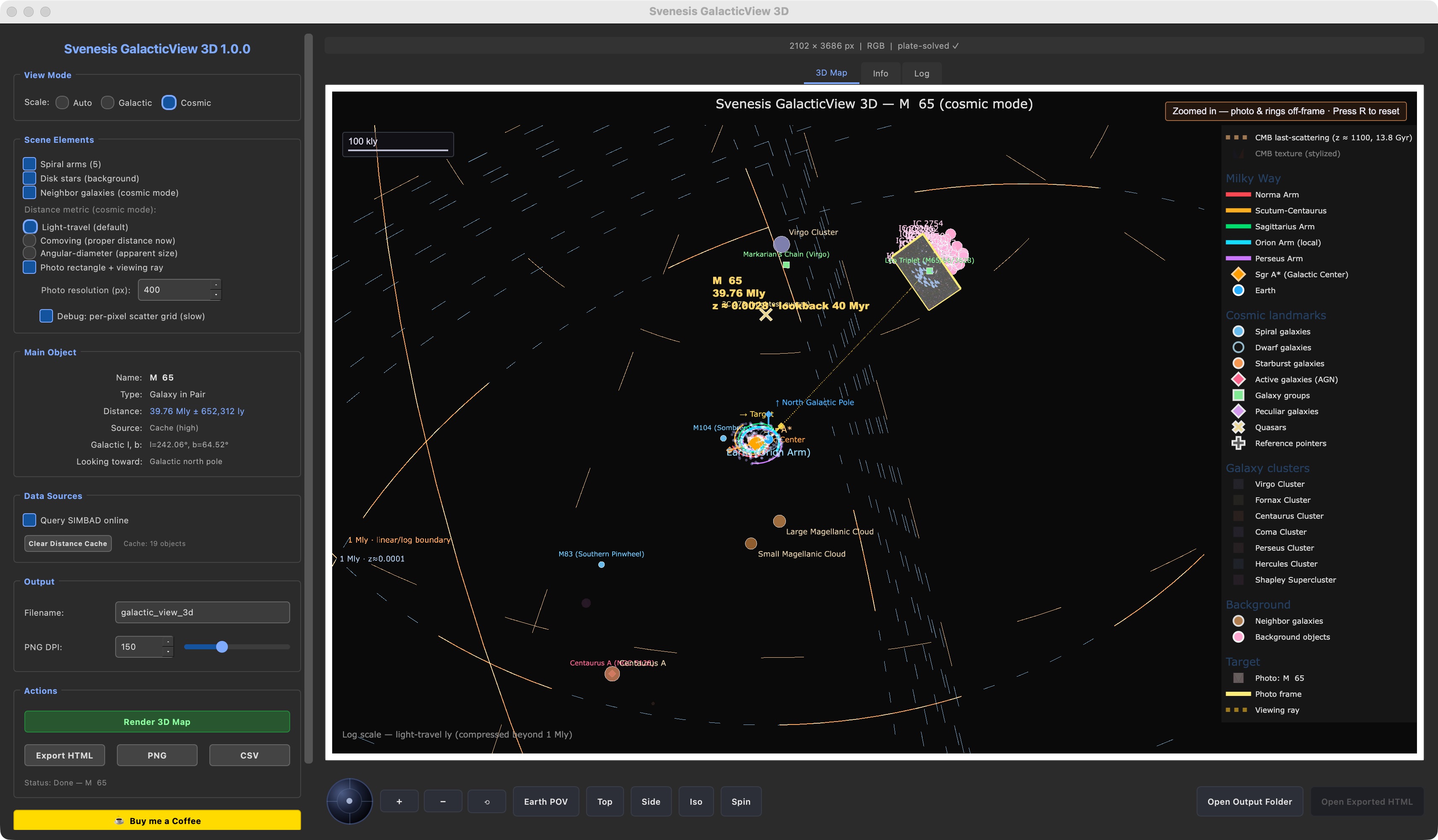
3D Scene Layout
- Image integration: plate-solved WCS maps the image to a textured rectangle positioned in galactic coordinates
- Five spiral arms: Perseus, Sagittarius, Scutum-Centaurus, Norma, and the Orion Spur
- Galactic disk (~500 representative stars) and bulge (~180 stars)
- Earth marked at ~26,000 ly from the galactic center
- Viewing ray from Earth through the image field, indicating the line of sight
- Rotatable embedded scene via Plotly and QWebEngineView
Distance Resolution
Priority chain:
- Local JSON cache (90-day TTL, stored at
~/.config/siril/svenesis_galacticview_cache.json) - SIMBAD
mesDistancetable - Redshift × Hubble law calculation (z < 0.5)
- Type-based median fallback (clearly labeled)
Object Selection
Color-coded taxonomy matching Annotate Image and CosmicDepth 3D: galaxies, emission and reflection nebulae, planetary nebulae, clusters, supernova remnants, dark nebulae, HII regions, named stars, asterisms, and quasars. A target disambiguation dialog handles ambiguous SIMBAD results.
User Interface
- 3D Map tab – embedded rotatable Plotly scene
- Objects tab – sortable table with distance and galactic coordinate data
- Log tab – diagnostic output
- Help dialog – informational tabs
- Dark-themed PyQt6 GUI
Export
- HTML – standalone interactive Plotly scene
- PNG – static export at the current camera angle via Plotly / kaleido
- CSV – full object table with galactic XYZ coordinates, distances, and sources
Workflow
Load and plate-solve an image in Siril → launch the script from Processing → Scripts → automatic distance resolution and mode selection → drag to rotate, scroll to zoom, hover for details → export as HTML, PNG, or CSV.
Dependencies
numpy, PyQt6, matplotlib, astropy, astroquery, plotly, kaleido; optional: PyQt6-WebEngine (in-app repair if missing)